
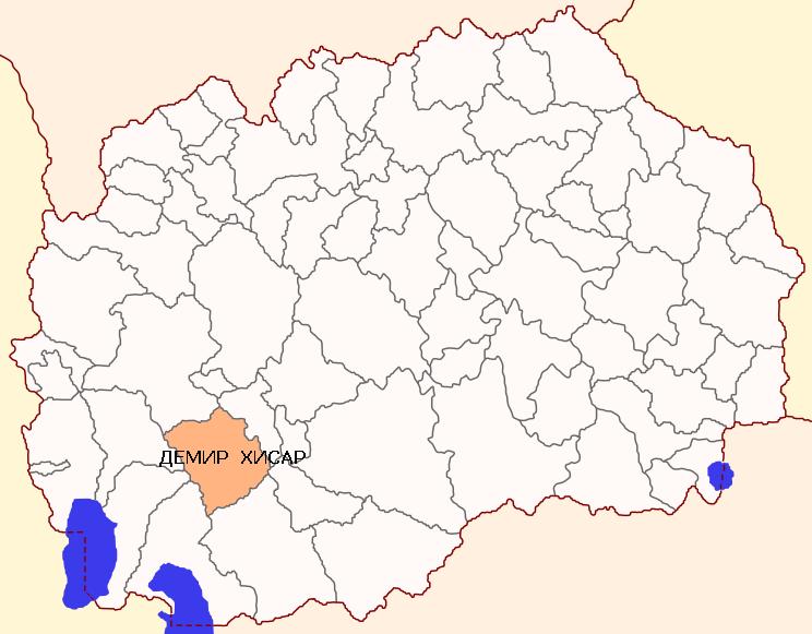
Municipality of Demir Hisar
Demir Hisar, or translated Iron Mountain (Zelezna Planina), is an area located in the southwestern part of Macedonia, northwest from Pelagonija valley, around the upper basin of the Crna Reka and its tributaries. In most, the relief is hilly -mountain, and a small part of the flow of the Crna Reka is lowland.
Special natural character that marks the area are mountains Bigla, Ilinska and Plakenska. The highest peak is 2.000 meters altitude and is a natural border between Demir Hisar and Prespa – Ohrid area.
Comparative advantages of the Municipality of Demir Hisar
The flora, especially forest vegetation in the municipality of Demir Hisar occupies large areas and features with relative preservation. The natural conditions and characteristics cause the appearance of two vegetation belts, oak and beech.
In the oak region there are several types of forests, ‘belgabrovo-blagunova’ forest, ‘ploskacheva’ forest and ‘gorunova’ forest. The largest areas of forest takes ‘ploskacheva’ forest and ‘gorunova’ forest, which climbs to the highest altitude of 1.200 m. The beech belt complements the oak and is present with the types of ‘podgorska’ and ‘gorska’ beech forest, and only very small areas occurs ‘subalpine’ beech forest (the highest areas of the mountain Bigla). In the mountainous areas mountain pastures are present and on the larger areas hilly pastures are present, mostly in the northern and eastern areas of the municipality.
Demir Hisar is an urbanized settlement of urban type that has all the conditions of a small town. There is a built electricity network, water supply, sewage, paved streets, street lighting. Demir Hisar town is municipal, administrative center of the municipality of Demir Hisar.
Municipality of Demir Hisar is connected with modern roads to the neighboring towns Bitola, Krusevo and Prilep Kicevo. Compared to the other municipalities in the region it is characterized by a competitive and skilled labor; competitive prices of agricultural and forest products and fruits, large water resources and good infrastructure.
The production of soft coal in Demir Hisar has its own tradition. The production of soft coal (charcoal) was one of the main existential activities in Demir Hisar gornoselie. Until a few decades the producers of soft coal produced only for the needs of blacksmiths, but in recent years the production has changed to so-called grill coal used in catering. It is impressive that in this craft after so many years remained the traditional way of production. As raw material for obtaining the coal is used oak and beech wood that is characterized by high-calorie. Therefore the Mrenoshki, Virovski and Smilevo soft coal are the most wanted on the market.
Municipality of Demir Hisar – Main data
| MUNICIPALITY OF DEMIR HISAR
st. “Bitolska“ n.n. Demir Hisar +389 47 552661 |
 |
| Coordinates | * Latitude – 41о22’ N
* Longitude – 21о20 E |
| Area | * 480,15 km2 |
| Areal codes | * International code: ++389(R. Macedonia)
* National code: 047 * Postal code: 7240 |
| Population | * 9.497 inhabitants (Census 2002)
* 8.439 inhabitants ( Estimated by the State Statistical Office, till 31.12.2014) |
| Gender structure | * Female – 48,61%
* Male – 51,39% |
| Number of unemployed people (ESA, December 2015 ) | * 1.060 |
| Elementary schools | * OOU “Goce Delchev“, Demir Hisar
* OOU “Dame Gruev“, v. Smilevo * OOU “Braka Miladinovci“, v.Zvan |
| Secondary schools | * SOU “Krste P. Misirkov“ |
| Banks (branches) | * Stopanska banka AD Bitola
* Stopanska banka AD Skopje |
| Insurance companies | * Eurolink osiguruvanje AD Skopje
* Triglav osiguruvanje AD Skopje * Sava osiguruvanje AD Skopje * Osiuruvanje Makedonija AD Skopje – Vienna Insurance Group * Viner osiguruvanje AD Skopje |
| Number of active legal entities | * 244 (State Statistical Office, till 31.12.2014) |
| Priority sectors /industries in the Municipality | * Agriculture
* Textile Industry * Metal processing industry * Nutritionally processing industry * Transport and services |
| Available resources in the Municipality | * Forests and Pastures
* Arable land * Berries * Water resources (rivers and small reservoirs) * Minerals (limestone, clay, marble) * Rich cultural-historical and ethnic heritage * Built infrastructure (local roads to all villages, water supply, sewerage networks in major urban areas) |
| Contact information for potential investors | * Mishe Miloshevski
Tel.: 047-552-661 E-mail: [email protected] * Zlate Boshevski Tel.: 047-552-661 E-mail: [email protected] |
Municipality of Demir Hisar – Traffic connections
| TRAFFIC CONNECTIONS | |
| Highways and national roads | · Highways E-65 · Highways E-75 · National road A3 · National road A2 |
| Regional roads | · R 1306 |
| Distance from airports: | · Alexander the Great (Skopje) – 167 km · St. Paul the Apostol (Ohrid) – 95 km · Airport Macedonia (Thessaloniki, Greece) – 235 km |
| Distance from harbors: | · Harbor in Burgas, Bulgaria- 729 km · Harbor in Thessaloniki, Greece – 220 km · Harbor in Durres, Albania – 256 km · Harbor in Bar, Montenegro – 351 km |
| Distance from railroads | · Railway station Skopje – 162 km · Railway station Sofia – 375 km · Railway station Thessaloniki – 220 km |
| Distance from capital cities: | · Skopje – 160 km
· Sofia – 375 km · Belgrade – 582 km · Podgorica – 368 km · Pristina – 237 km · Athens- 576 km · Tirana – 220 km |
| Distance from border crossings: | · Bulgaria- 262 km
· Serbia – 200 km · Greece – 43 km · Kosovo – 168 km · Albania – 82 km |
Municipality of Demir Hisar – Investing opportunities
In the municipality of Demir Hisar the industrial zone “Demir Hisar” is located. This industrial zone is located on the regional road R-416 Bitola – Kicevo, 1 kilometer away from Demir Hisar. The industrial zone “Demir Hisar” is with area of 33.349,70 m2. The percentage of construction in the area is 68,25%. The purpose of free land in the Industrial Zone is for light and non-polluting industry, and the land can be leased or sold.
| Industrial zone “Demir Hisar” | |
| Total area | 33.349,70 m2 |
| Distance from the center of the municipality | 1 km |
| Ownership | 100 % state owned |
| Infrastructure | No infrastructure |
| Usage of the free locations for construction | G2 – light and non-polluting industry |
| Initial price for the land | 240,00 den./m2 |
Municipality of Demir Hisar to the potential investors has made available and gives them an opportunity to use the facilities in the municipal property for business purposes and long-term lease of buildings for business purposes:
| Information about potential selling locations | |||
| Number | Description | Location | Total area |
| 1 | Location within the OOU “Dame Gruev” | v. Smilevo, Demir Hisar | 576,00 m2 |
Possibility of tourist development zone in the municipality of Demir Hisar
In the municipality of Demir Hisar in KO Slepce there is a possibility of forming a tourism development zone. For this area of 22.000 square meters a geodetic report is made as an updated base on which there will be a urban plan developed. This region has the potential to develop the recreational and health tourism. Slepche is located 2 km from Demir Hisar and has an urban plan and infrastructure ensured. The proximity to Demir Hisar allows the use of all existing facilities, stadium, gymnasium, Cultural, Health Centre and educational institutions. In v. Slepche of great importance is the existence of two monasteries “Ss. John the Baptist” and “Istochen Petok” which are visited by many people from the region and abroad. In these monasteries there are accommodations facilities but they are not categorized.
The beneficial conditions, pure nature, rich air with oxygen ranks , this area highly in the green zone with a strong energy value. The area has the potential to produce healthy food, has a large number of sources of clean and healthy water for drinking and irrigation, the configuration of the land, the landscape of mountains and hills are rich in pastures and has a favorable condition for the development of animal husbandry. The area has several kinds of herbs, teas and berries.