
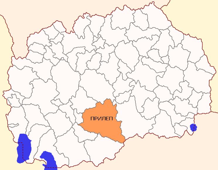
Municipality of Prilep
Municipality of Prilep is located in the central southern area of the Republic of Macedonia, the northern part of the largest granary in the country, Pelagonia. The municipality covers an area of 1,195 km2 in area and is the largest municipality in Macedonia. The municipality includes 59 settlements – Prilep and 58 villages. In terms of the number of residents, the municipality is in the fifth place out of 84 municipalities. The municipality includes part of the highland Mariovo which borders by a small part with Greece.
Comparative advantages of the Municipality of Prilep
Prilep is about 60 kilometers from the southern border of the Republic of Macedonia with Greece. There is railway that passes through the town which connects Bitola, Veles, Prilep and Skopje and through Skopje links the city to other countries. Prilep is distanced from Thessaloniki, Greece (port and airport) in about 210 km. The town is connected to Skopje and Thessaloniki by highway E75 and M5 national road. It is 240 km from the port of Durres, R. Albania.
The agriculture in Prilep is one of the most developed industries. The most common crops are: tobacco, cereals and horticulture. Municipality of Prilep is known, and in the country and abroad, by tobacco production which occupies most of the total agricultural production. That is the reason Prilep is called the tobacco town.
The region in which Prilep extends is rich in deposits of marble and granite. The main mines are located in places Sivec, Kukul, Pletvar, Belovodica, Trojaci, Nebregovo and Sliva.
Municipality of Prilep – Main data
| MUNICIPALITY OF PRILEP
St.“Prilepski braniteli” no.1 +389 48 401 701 |
 |
| Coordinates | * Latitude – 41о21’22” N
* Longitude – 21о35’7” E |
| Area | * 1.195 km2 |
| Areal codes | * International code: ++389(R. Macedonia)
* National code: 048 * Postal code: 7500 |
| Population | * 76.768 inhabitants (Census 2002)
* 75.674 inhabitants ( Estimated by the State Statistical Office, till 31.12.2014) |
| Gender structure | * Female – 49,82%
* Male – 50,18% |
| Number of unemployed people (ESA, December 2015 ) | * 7.195 |
| Elementary schools | * OU “Blaze Koneski “
* OU “Kliment Ohridski“ * OU “Kire Gavrilovski “ * OU “Dobre Jovanoski “ * OU “Goce Delchev“ * OU “Rampo Levkata“ * OU “Kocho Racin“ * OU “Kiril and Metodij” – Kanatlarci * OU “Petre Gligurovski” – Crnilishte * OU “Krume Volparoski“ – Topolchani * OU “Strasho Pindzur“ – Malo Konjari |
| Secondary schools | * SOU Gymnasium “Mirche Acev”
* SOU “Gjorche Petrov“ · health profession · textile, leather profession · personal services · forestry, wood processing branch · geological-mining and metallurgical branch * SOU “Orde Chopela” · agriculture veterinary profession · dry-tech profession · personal services · construction and geodetic field * SOU “Kuzman Josifovski – Pitu” · Economic-legal and commercial field * SOU “Riste Risteski – Richko” · mechanical engineering · electrotechnical branch · traffic profession · high School Sports · graphic profession |
| Universities and scientific institutions | * University “St. Kliment Ohridski” – Bitola (www.uklo.edu.mk)
· Economic faculty – Prilep · Dispersed studies: Informatics and Computer Technologies Production and processing of tobacco Geology and Mining * Tobacco Institute * Institute for Old Slavonic culture * Institute of composite materials and robotics * Workers University |
| Banks (branches) | * Stopanska banka AD Skopje
* Stopanska banka AD Bitola * Komercijalna banka AD Skopje * Eurostandard banka AD Skopje * UNI banka AD Skopje * Prokredit banka AD Skopje * Halk banka AD Skopje * Alfa banka AD Skopje * NLB Tutunska banka AD Skopje * Sparkase banka AD Skopje * TTK banka AD Skopje * Ohridska banka AD Skopje |
| Insurance companies | * Triglav osiguruvanje AD Skopje
* Osiguruvanje Makedonija AD Skopje – Vienna Insurance Group * Insig Македонија AD Skopje * Sava osiguruvanje AD Skopje * Evroins osiguruvanje AD Skopje * AD Osiguritelna polisa * Albsig AD Skopje * Kroacija osiguruvanje AD Skopje * Unika AD Skopje * Eurolink osiguruvanje AD Skopje * Viner osiguruvanje AD Skopje |
| Number of active legal entities | * 2.688 (State Statistical Office, till 31.12.2014) |
| Priority sectors /industries in the Municipality | * Tobacco
* Food industry * Mining * Agriculture (predominant culture is tobacco) * Textile Industry * Trade * Industry for the production of CNC machines and robotics * Metalworking industry |
| Available resources in the Municipality | * Agriculture
* Energy * Mining * Tourism (Cultural – historical attractions and * Cultural events) * Infrastructure |
| Contact information for potential investors | * Cvete Stanojoska
Local Economic Development Tel.: +389 77 540 919 E-mail: [email protected] [email protected] * Aleksandra Kokaroska Chief of Staff to the Mayor Tel.: +389 76 453 070 E-mail: [email protected] |
Municipality of Prilep – Traffic connections
|
TRAFFIC CONNECTIONS
|
|
| Highways and national roads | · Highway Е-75
· National road А-1 · National road А-3 |
| Regional roads | · National road А3 (to Bitola)
· R1101 (Prilep – Bitola) · R1303 (to Kichevo) · R1306 (to Krushevo) · National road А1 (to Gradsko) |
| Distance from airports: | · Alexander the Great (Skopje) – 130 km
· St. Paul the Apostol (Ohrid)) – 125 km · Airport Macedonia (Thessaloniki, Greece)- 210 km |
| Distance from harbors: | · Harbor in Burgas, Bulgaria – 696 km
· Harbor in Thessaloniki, Greece – 220 km · Harbor in Durres, Albania – 240 km · Harbor in Bar, Montenegro – 380 km |
| Distance from railroads | · Railway station Skopje – 126 km
· Railway station Sofia – 323 km · Railway station Thessaloniki – 216 km |
| Distance from capital cities: | · Skopje – 126 km
· Sofia – 323 km · Belgrade – 526 km · Podgorica – 399 km · Pristina – 212 km · Athens – 676 km · Tirana – 245 km |
| Distance from border crossings: | · Bulgaria- 163 km
· Serbia – 144 km · Greece – 61 km · Kosovo – 142 km · Albania – 134 km |
Investing in the municipality of Prilep
Municipality of Prilep for the potential investors makes available:
- Technological Industrial Development Zone – TIDZ Prilep
- Industrial Zone Prilep 1
- Industrial Zone Prilep 2
- Industrial Zone Prilep 3
The Technological Industrial Development Zone Prilep – locality Alinci is located in the southwestern part of the city, along the regional road M5. TIDZ Prilep is at a 10 km distance from the center of Prilep. This Technological Industrial Development Zone has a total area of 675.062,22 m2.
TIDZ Prilep is fully state-owned and is managed by the Directorate for Technological Industrial Development Zones (www.fez.gov.mk).
The area has access to electricity, water supply, atmospheric canalization, sewage, telephones and access to construction parcels via asphalt road or mended surface.
| TIDZ Prilep | |
| Total area | 675.062,22 m2 |
| Distance from the center of the municipality | 10 km |
| Ownership | 100 % state owned |
| Managed by | Directorate for Technological Industrial Development Zones |
| Infrastructure | – Electricity
– Water supply – Stormwater drains – Sewerage system – Telephony – Access to construction plots through asphalt / swabbed area |
| Usage of the free locations for construction | Industrial capacities |
| Initial price for the land | 61,50 den/m2 |
The Industrial zone Prilep 1 is located in the southwestern part of the city, along the regional road to Bitola. The area itself has the necessary infrastructure – water, sewerage and electricity. The total surface area is 20 hectares. The free building lots are intended for: Facilities for light and non-polluting industry.
| Industrial zone Prilep 1 | |
| Total area | 20 ha |
| Distance from the center of the municipality | 3 km |
| Ownership | 100 % state owned |
| Infrastructure | – Electricity
– Water supply – Stormwater drains – Sewerage system – Telephony – Access to construction plots through asphalt / swabbed area |
| Usage of the free locations for construction | Industrial capacities |
The Industrial zone Prilep 2 is located in the southwestern part of the city, along the regional road to Bitola, in the area of the former livestock market. The area itself has the infrastructure necessary for undisturbed operating: water, sewerage and electricity. The total area of the industrial zone is 3,6 ha. The available building lots are intended for: Facilities for light and non-polluting industry and services.
| Industrial zone Prilep 2 | |
| Total area | 3,6 ha |
| Distance from the center of the municipality | 1,5 km |
| Ownership | 100 % state owned |
| Infrastructure | – Electricity
– Water supply – Stormwater drains – Sewerage system – Telephony – Access to construction plots through asphalt / swabbed area |
| Usage of the free locations for construction | Buildings for light and non-polluting industry and services |
The Industrial zone Prilep 3 is located in the northwestern part of the city, along the regional road R513 to Makedonski Brod. Near the zone there is complete necessary infrastructure: water supply, sewerage and electricity. The total area of the industrial zone is 381.600 m2.
| Industrial zone Prilep 3 | |
| Total area | 381.600 m2 (38,16 ha) |
| Distance from the center of the municipality | 1,6 km |
| Ownership | 100 % state owned |
| Infrastructure | – Electricity
– Water supply – Stormwater drains – Sewerage system |
In the municipality of Prilep, currently under construction is a “greenfield” investment of “Gentherm”, a company specialized for automobile industry. A successful example of “brownfield” investment is the Italian company for producing lights, “Buzzi & Buzzi”. In the upcoming period in TIDZ Prilep a “greenfield” investment – company from Germany “Akomplast” has been announced, a company from the automotive industry.
In the industrial zone “Prilep 1” there is ongoing construction of 5 facilities on 4 locations. Facilities are being built by the companies: Triteks Trade, Donia Ltd., Provista, Godom Ltd. and Unikat construction.